
Some hikes are pretty. Some are famous. And a small, stubborn handful are simply hard in a way that rearranges how you think about your own body.
This guide is about that last group. These are the hardest hikes in the world: trails where altitude steals your appetite, where a bad weather window can end a three-week plan in a single afternoon, and where plenty of fit, well-prepared people still turn around. They are not all technical climbs. Most don’t need ropes or ice axes. They just ask for more than a normal holiday ever would: more days, more thin air, more cold, more patience.
We went through what the leading hiking lists, difficulty indexes, trekking operators and mountain guides say about these routes, compared their claims, and then ranked 15 trails by how difficult they really are to finish, not just how scary they look in photos. For each one you’ll get the distance, the altitude, the toughest section, the best season, the permit situation and one honest tip.
Also Read : Europe Winter Destinations: Where to Go When the Cold Sets In (and Why You Should)
A quick note before we start. Hard does not mean impossible, and it definitely doesn’t mean reckless. Every route below can be done safely with the right preparation, the right guide and a willingness to turn back. Several of them also have real fatality and failure statistics, which we mention where they matter, because you deserve the truth before you book a flight.
What Actually Makes a Hike ‘Hard’?
Before ranking anything, it helps to agree on what ‘hard’ means. Online lists often mix four very different things together: scary, dangerous, long and tiring. A trail can be one without being the others.
Here are the factors we weighed.
1. Altitude and acclimatisation. This is the great equaliser. Above roughly 3,500 metres (11,500 feet) your body works harder for every breath, and above 5,000 metres (16,400 feet) even simple tasks feel like effort. Fitness helps, but it doesn’t fully protect you from altitude sickness. Marathon runners get it. Beginners sometimes don’t.
2. Duration and cumulative fatigue. A brutal one-day hike is a different animal from 25 days of back-to-back effort. On the longest routes, the hardest enemy is not any single climb. It’s the slow erosion of sleep, appetite, motivation and joints.
3. Terrain and exposure. Loose scree, boulder fields, glacier moraine, river crossings and cliff-hugging paths all cost energy and nerve. Exposure, meaning a big drop beside the trail, adds a mental load that tires you quickly.
4. Weather and temperature. Sub-zero nights, afternoon storms, snow on high passes and sudden whiteouts can turn a manageable day into a survival decision.
5. Remoteness and logistics. The further you are from a road, a clinic or a helicopter landing zone, the more serious every small problem becomes. Remote routes also need permits, guides and long planning lead times.
6. Completion rate. This is the honest scoreboard. When roughly half of the people who start a trek don’t finish it, as operators say about Bhutan’s Snowman Trek, the route has earned its reputation.
One more thing worth saying: published difficulty rankings disagree with each other a lot. One gym-brand study that analysed more than 130 bucket-list trails put Malaysia’s Mount Kinabalu at the top of its index. Gear brands and trekking companies tend to favour long Himalayan routes. Travel magazines lean toward dramatic danger like cliff paths and cable climbs. None of them is wrong. They’re just measuring different things. Our list blends all of these angles and tells you which kind of hard you’re signing up for.
The 15 Hardest Hikes in the World at a Glance
| # | Hike | Country | Typical length | Max altitude | Main challenge |
|---|---|---|---|---|---|
| 1 | Snowman Trek | Bhutan | 25-30 days | ~5,300 m | Duration, passes, remoteness |
| 2 | K2 Base Camp and Concordia | Pakistan | 12-14 days | ~5,100 m | Glacier travel, logistics |
| 3 | Kanchenjunga Base Camp | Nepal | 20-25 days | ~5,100 m | Remoteness, long days |
| 4 | Aconcagua | Argentina | 17-20 days | 6,961 m | Extreme altitude, wind |
| 5 | Everest Three Passes | Nepal | 18-21 days | 5,535 m | Three high pass crossings |
| 6 | Huayhuash Circuit | Peru | 8-12 days | ~5,000 m | Non-stop passes |
| 7 | Kilimanjaro, Umbwe Route | Tanzania | 5-6 days | 5,895 m | Steep, fast ascent |
| 8 | Appalachian Trail | USA | 5-7 months | ~2,025 m | Sheer duration |
| 9 | GR20 | France (Corsica) | ~15 days | 2,000 m+ | Rock scrambling, climbing volume |
| 10 | Huemul Circuit | Argentina | 4 days | ~1,500 m | Navigation, river crossing |
| 11 | Chadar Trek | India (Ladakh) | ~9 days | ~3,400 m | Frozen river, -20 C |
| 12 | Mount Kinabalu | Malaysia | 2 days | 4,095 m | Steep granite, pre-dawn push |
| 13 | Half Dome | USA | 1 day | 2,694 m | Distance, cables |
| 14 | Mount Huashan | China | 1 day | 2,154 m | Plank paths, exposure |
| 15 | Ciudad Perdida | Colombia | 4-5 days | ~1,200 m | Heat, humidity, stairs |
The order is our editorial judgment, weighing difficulty for an experienced but non-professional hiker. Distances and altitudes are approximate and vary by source and by the exact variation you pick. This table is our ranking of the hardest hikes in the world.
1. Snowman Trek, Bhutan
Length: about 300 km (186 miles) | Time: 25-30 days | Highest point: roughly 5,300 m (17,400 ft) | Best season: April-May and mid-September to October
If one trek deserves the title of hardest hike in the world, this is the one most mountain guides name first. The Snowman Trek crosses the entire northern edge of Bhutan, linking Paro in the west to the Bumthang region in the east, and it takes close to a month of continuous effort.
The numbers are what make it special. Depending on the operator and variation, you cross around 11 high passes, many of them above 5,000 metres. The highest, usually given as Rinchen Zoe La, sits at roughly 5,300 metres, though different sources list slightly different heights, so treat any single figure with a pinch of salt. Camps in the Lunana region can see night temperatures of -15 C or colder. Several outfitters and National Geographic reporting describe a completion rate of around 50 percent, and others say 60 to 70 percent for well-supported groups. Either way, a lot of people go home early.
Must Read : Best Things to Do in Seville: A Local-Style Guide for Your First Trip (or Your Fifth)
Why does it fail so many people? Mostly because of how the route is built. You spend more than two weeks above 4,000 metres, so altitude sickness is a constant risk, not a one-day problem. There are very few exit points. A storm can pin you in camp for days. And because the trail is remote, evacuation can take a long time. In 2016, an attempted speed record by ultrarunners turned into a medical emergency, which tells you how little respect the route gives to raw fitness alone.
The toughest stretch is the middle section through Lunana, the remote region of glacial lakes and tiny villages that few travellers ever see. Here you stack high pass on high pass with cold camps in between. One pass crossing near the 5,200 m mark is often called the single hardest day.
There is a bright side. Bhutan limits visitors, so you are unlikely to share the trail with crowds. You’ll walk past yak herders, stone villages and views of Gangkhar Puensum, widely described as the highest unclimbed mountain on Earth.
Permits and cost: Foreign trekkers must go with a licensed Bhutanese operator, and the country charges a daily Sustainable Development Fee on top of trek costs. Total prices commonly run into the thousands of dollars, with some packages quoted well above that. Always check the current fee when you book.
Our tip: Don’t choose this trek because you want a story. Choose it because you’ve already done at least one multi-week high-altitude trip and know how your body behaves. Build in acclimatisation days and pick a guide company that is honest about turnaround rules.
2. K2 Base Camp and Concordia, Pakistan
Length: about 12-14 days round trip from Askole | Highest point: around 5,100 m at K2 Base Camp | Best season: June to August
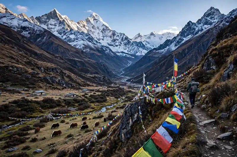
The walk to K2 is arguably the most dramatic trek on the planet. It follows the Baltoro Glacier, a river of ice that grinds between towers like Trango, Masherbrum and Gasherbrum. At Concordia, where several glaciers meet, you stand in a natural amphitheatre of peaks above 7,000 metres, with K2, the world’s second-highest mountain at 8,611 metres, filling the horizon.
It’s physically heavy in a quiet way. The days are long, the glacier surface is uneven rock and ice, and the altitude creeps up on you. You don’t walk on a path. You walk on moving moraine, picking a line across loose boulders, stream channels and crevasse zones while carrying only a day pack. Porters handle the heavy loads, but you still burn serious energy every day.
Camps are basic, toilets are limited, and weather can be sudden. Cold nights are normal even in midsummer, and rockfall and glacial stream crossings add risk. A rescue here would be slow compared with a Nepali trail with lodges and frequent flights.
The other part of the difficulty is logistics. You need a licensed trekking operator, permits for the Gilgit-Baltistan region, porters, a cook and a liaison arrangement. Road travel to Skardu and Askole is part of the adventure, and delays from weather or landslides are common. Build spare days into your plans.
For trekkers who want something more extreme, the route can be extended across the Gondogoro La, a high pass above 5,500 metres that requires fixed ropes and strong glacier skills. That extension pushes the whole trip into serious mountaineering territory.
Our tip: Treat Concordia, not K2 Base Camp, as your realistic first goal. Many trekkers find that standing at Concordia is already the highlight of their lives, and the base camp push is the bonus.
3. Kanchenjunga Base Camp, Nepal
Length: 20-25 days | Highest point: about 5,100 m at Pangpema (North Base Camp) | Best season: March to May, October to November
Kanchenjunga, at 8,586 metres, is the third-highest mountain in the world, and the trek to its base is one of the most remote walks in Nepal. Where Everest Base Camp has tea houses every few hours, Kanchenjunga has long stretches of simple lodges, camping and almost no phone signal.
The difficulty comes from sheer time and effort. The trail climbs and falls through rhododendron forest, terraced villages, steep river valleys and high meadows, sometimes gaining and losing a thousand metres in a day. The north side leads to Pangpema, and trekkers who want the full experience often add the south side too, which makes the trip much longer and harder.
Because it is a restricted area, you need a special permit, and a licensed guide is required, with minimum group size rules. Medical help is far away. Weather can bring heavy rain, leeches in the low sections and snow up high. Food options get plainer and more repetitive the further you go.
What you get in return is quiet. You can spend whole days without seeing another foreign trekker. For many people who have done the Everest region and want something harder and wilder, Kanchenjunga is the natural next step.
Our tip: Pack for long stretches of basic lodging. A good sleeping bag liner, a water filter, snacks and a power bank matter more here than on any popular route.
4. Aconcagua, Argentina
Length: 17-20 days | Highest point: 6,961 m (22,838 ft) | Best season: December to February
Aconcagua is the highest mountain outside Asia and the tallest peak in both the Southern and Western Hemispheres. The main routes are non-technical, which means no ropes or ice axes are needed in normal conditions. That description fools people. Don’t underestimate it.
The problem is altitude and weather. Summit day alone can last 10 to 14 hours at nearly 7,000 metres, where oxygen is about a third lower than at sea level. Winds can be violent, and temperatures at high camps drop to -20 C or lower. Reported summit success rates are often quoted around 30 to 40 percent, with most failures due to weather, altitude sickness or simply running out of energy.
You also have to haul gear and move between camps, which is why expeditions take around three weeks even though the final push is one day. A permit from the Argentine provincial park authority is required and fees are significant.
The mountain demands patience. Most people who succeed do so because they respected the schedule, drank plenty, ate even when they didn’t want to and turned back when conditions were poor.
Our tip: Spend a few days acclimatising and carry-hauling gear before attempting a summit push, and keep an extra day in your plan for bad weather.
5. Everest Three Passes Trek, Nepal
Length: 18-21 days | Highest point: Kongma La at 5,535 m | Best season: April-May, October-November
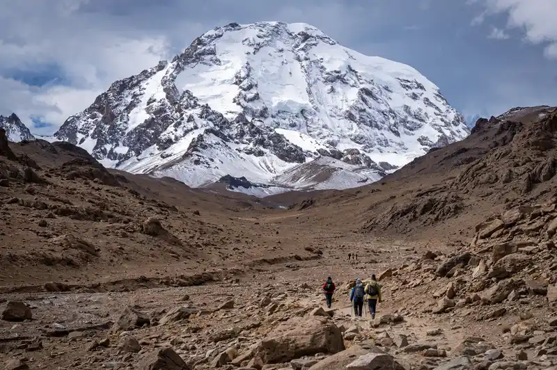
Everest Base Camp is demanding by itself, and many lists treat it as one of the hardest non-technical hikes simply because you spend so long at altitude. The Three Passes route takes that and pushes it further. You cross three high passes in the Khumbu: Kongma La, Cho La and Renjo La, linking the Everest, Gokyo and Chhukhung valleys into a giant loop.
What makes it so hard is repetition. You gain altitude, go over a pass, drop, climb again, and do it three times. Kongma La, around 5,535 metres, is usually the toughest because of its steep, loose approach and long day. Cho La involves a glacier crossing with a short ice section, and Renjo La gives sweeping views but arrives late in the loop when you’re tired.
Read Must : Ancient Roman Roads: The Remarkable Engineering That Connected an Empire
Some trekking guides quote dropout rates as high as 70 percent for the full circuit, though numbers are rough and depend on who’s counting. Many people who quit do so because of altitude sickness, stomach illness, cold or simply exhaustion.
The upside is infrastructure. Tea houses, clinics and helicopter rescue make this safer than truly remote routes, but you still need good acclimatisation, a flexible schedule and a guide or experienced companions.
Our tip: Do the loop clockwise or counter-clockwise based on acclimatisation, not on photos. Starting with the lower passes and saving Kongma La for when you’re best adjusted is a common approach among guides.
6. Huayhuash Circuit, Peru
Length: about 130 km (80 miles) | Time: 8-12 days | Highest point: roughly 5,000 m | Best season: June to September
The Cordillera Huayhuash is a compact range with a big reputation. The circuit around it is often called one of the most beautiful treks on Earth, and one of the most exhausting. There are no easy days here. Almost every day involves at least one pass above 4,500 metres, followed by a steep drop and another climb.
So the difficulty is not one massive effort. It’s relentless up-and-down at altitude, with very little recovery. Camp spots sit at 4,000 to 4,700 metres, which means you rarely sleep low enough to reset. Weather is cold and changeable, and the dry season brings strong sun, bitter wind and sometimes sudden snow.
The trail also asks for logistics and respect. Local communities manage the land and charge fees at checkpoints, so you need cash in small bills, and most trekkers go with an agency or a muleteer team. Walking independently is possible but more complicated, and navigation on some high sections can be tricky.
If you’re looking for scenery, nothing on this list beats it per kilometre. Turquoise lakes sit under glaciers, and jagged peaks look almost too steep to be real.
Our tip: Spend several days around Huaraz or Cusco before you start. Arriving straight from sea level is the most common cause of rough first nights.
7. Kilimanjaro via the Umbwe Route, Tanzania
Length: about 50 km | Time: 5-6 days | Highest point: Uhuru Peak, 5,895 m (19,341 ft) | Best season: January-March and June-October
Kilimanjaro itself is not a technical climb, and most people finish it with the right pacing. But the Umbwe route is a very different story, and trekking guides regularly name it the hardest way up. It is steep, direct and gains altitude quickly, which makes acclimatisation difficult.
The path starts in thick rainforest and climbs fast, with roots, slippery rocks and tight ridgelines. By day two you’re already above the clouds on a narrow route with exposed sections. The itinerary is short, which sounds appealing until you realise your body has far less time to adapt to thin air.
Summit night is the same as on every route: you start around midnight, climb for six to eight hours in the dark through freezing temperatures, and reach Uhuru Peak at sunrise. By then you’ve often slept poorly for several nights, and the last push on loose volcanic scree feels like walking through sand.
Published figures put overall Kilimanjaro success rates well below 100 percent, and shorter, steeper routes tend to see lower numbers. Longer itineraries such as the Lemosho or Northern Circuit give a much better chance of summiting.
Our tip: If you want a challenge, Umbwe is it. If you want the summit, choose a longer route and give your body time.
8. Appalachian Trail, USA
Length: about 2,200 miles (3,500 km) | Time: 5-7 months | Highest point: Clingmans Dome, about 2,025 m (6,643 ft) | Best season: March start (northbound) to September-October finish
The Appalachian Trail is not high, and it isn’t technical. So why is it here? Because it is the best example of how duration can make a hike hard.
A thru-hike runs through 14 states from Georgia to Maine. You’ll climb and descend roughly the equivalent of Mount Everest many times over, walking an average of 15 to 20 miles a day for months. Blisters, tendon injuries, bad weather, loneliness and simple boredom grind people down. Most estimates suggest that only around one in four who start a thru-hike makes it all the way to Katahdin.
The terrain has its own bite. The White Mountains in New Hampshire and the Mahoosuc Notch in Maine are among the slowest, hardest miles. Weather shifts quickly, and cold rain in the Smokies or New England can be dangerous if you’re underprepared.
It is also a logistical puzzle: resupply every few days, rest days in trail towns, gear swaps for changing seasons. Anyone who finishes learns as much about patience as about hiking.
The good news is that the trail is well-marked, has shelters and a huge community, and it’s one of the safest long-distance routes for a first thru-hike.
Our tip: Start slow. Most injuries happen in the first month when people try to prove something. Fifteen comfortable miles beat twenty painful ones.
9. GR20, Corsica, France
Length: about 180 km (112 miles) | Time: about 15 days | Highest point: over 2,000 m | Best season: June to September
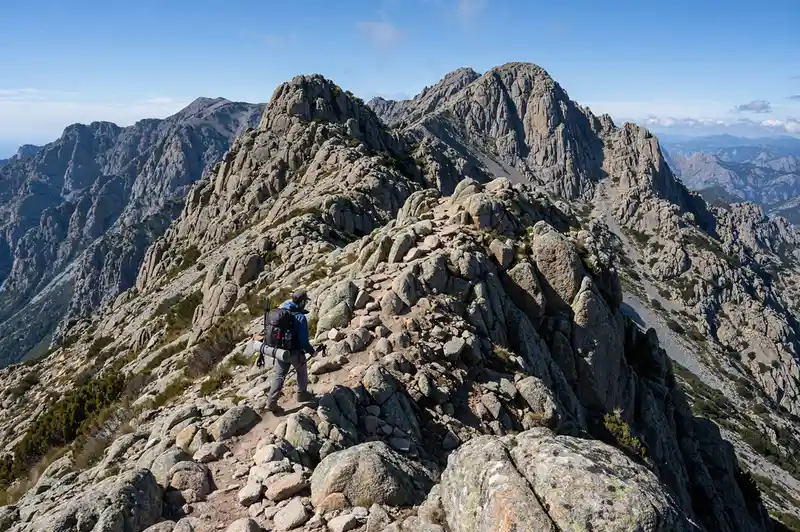
The GR20 is often called the toughest long-distance trail in Europe. It crosses the spine of Corsica from north to south, and it does so in a very direct way: straight up and over rocky ridges rather than around them.
The northern half is the hardest. Expect granite slabs, chains and ladders on steep sections, boulder fields and long scrambles where you use your hands. Total ascent over the whole route is more than 10,000 metres. Weather can swing from scorching to stormy, and afternoon thunderstorms are a real hazard on exposed ridges.
What makes it so punishing is the constant technical walking. Even on flat sections you’re stepping over rocks, so your pace is slow and your knees and ankles take a beating. Refuges are basic, and there are limited supplies on the way, so your pack weight matters a lot.
Mountain IQ and other guides list it among the toughest treks in the world, and it regularly appears on lists of the best hikes in Europe for the same reason: it’s rewarding and rough in equal measure.
Our tip: Book refuge spots early in summer, travel light and go south to north if you want an easier first half, or north to south if you prefer to get the hardest part done early.
10. Huemul Circuit, Argentina
Length: about 65 km | Time: 4 days | Highest point: roughly 1,500 m | Best season: December to March
Patagonia delivers some of the world’s most spectacular walks, but the Huemul Circuit is a step above the typical Fitz Roy day hike. It loops around the southern edge of the Southern Patagonian Ice Field near El Chaltén, with big glacier views and very little infrastructure.
The route is rough and fairly exposed. You’ll face steep, muddy slopes, boulder hopping, bush-whacking in places and a famous river crossing using a hand-pulled cable system. Navigation is tricky because marked trail sections are sparse, so you need map-reading skills and a GPS.
Read Also : Best Places to Snorkel in Hawaii: 12 Spots Worth Getting Wet For
Then there’s the weather. Patagonian wind is legendary. A calm morning can turn into a gale by afternoon, and rain can swell rivers quickly. The trail is short on paper, but the real time varies a lot depending on conditions.
It isn’t the longest or highest hike on this list. It earns its place because it asks for independence, solid skills and good judgment. Rules and registration requirements have changed in recent years, so always check with the local park office before you go.
Our tip: Carry a full waterproof kit, a satellite messenger and a plan for a rest day. The weather, not you, decides your schedule here.
11. Chadar Trek, Ladakh, India
Length: about 105 km round trip | Time: around 9 days | Highest point: roughly 3,400 m | Best season: late January to February
Imagine walking on a frozen river. That’s the Chadar. In winter, the Zanskar River freezes into a ribbon of ice, and for centuries villagers used it as a seasonal highway. Trekkers follow the same route today, sleeping in caves and tents beside the ice.
The altitude is moderate, but the cold is not. Temperatures regularly fall to -20 C and can go lower at night. The ice itself can be thick and stable in some places and thin or broken in others, so a guide who reads the ice is non-negotiable. Slips and falls into freezing water are the main danger.
Because conditions depend on ice formation, the season is short and unpredictable. Road construction in the region has also affected access and the trek’s future in recent years, so check current conditions with a local operator before planning a trip.
It is a very physical experience in a different way from mountains. You’re cold, you’re carrying layers, you’re moving carefully on slippery surfaces, and you sleep badly in extreme conditions. The reward is a landscape that feels almost lunar.
Our tip: Cold management is everything. Bring insulated boots, spare gloves, a proper -20 C sleeping bag and hot drinks in a flask.
12. Mount Kinabalu, Malaysia
Length: about 8.7 km one way on the main route | Time: 2 days | Highest point: 4,095 m (13,435 ft) | Best season: March to September
Mount Kinabalu in Borneo showed up at the top of one gym brand’s global difficulty index, which analysed more than 130 bucket-list trails. That ranking surprises people, because on paper it’s a short climb. In practice, it’s steep, hot at the bottom, cold at the top and unforgiving at 2:30 in the morning.
Here’s how it works. On day one you climb from the park gate to a mountain lodge at Laban Rata, a long staircase of roots, steps and rock that takes five to six hours. You sleep a few hours, wake in the middle of the night and head up in the dark across bare granite, using a rope to guide you over steep slabs. You reach Low’s Peak around sunrise, then descend all the way to the bottom the same day.
That last part is what breaks knees. Total descent can feel endless, and many climbers end up with shaking legs and bruised toes. Altitude headaches are common even at a modest 4,095 metres.
Permits and guides are mandatory and book out well in advance, so plan ahead. Experienced climbers can also try the Via Ferrata, a fixed-cable route along the mountain’s flank, which adds exposure and thrills.
Our tip: Bring poles and warm layers. The summit plateau is much colder than you expect after the humid forest.
13. Half Dome, Yosemite, USA
Length: about 14-16 miles round trip | Elevation gain: roughly 4,800 ft | Highest point: 8,839 ft (2,694 m) | Best season: late May to early October, when the cables are up
Half Dome is a single-day hike, but it’s one of the toughest day hikes in North America. The route from Yosemite Valley takes you past waterfalls on the Mist Trail, up a long granite staircase, through forest and finally to the base of the dome itself, where the real test begins.
The last stretch is a steep granite slope with two metal cables serving as handrails. You pull yourself upward on a very steep incline, with a serious drop on either side. Many people find the mental side harder than the physical side. Crowds can add stress, and the rock gets slippery in wet or windy weather.
One reason this hike lands on so many danger lists is that accidents have happened here over the years, including falls and lightning incidents. That’s why a permit system is used to limit numbers, and it’s essential to check the current rules before you travel.
A typical hiker needs 10 to 14 hours. Start before dawn, carry plenty of water, wear gloves for the cables and turn back at the first sign of thunderstorms.
Our tip: Don’t start the cables if clouds are building. Lightning on exposed granite is far more dangerous than a missed summit.
14. Mount Huashan, China
Length: varies by route | Highest point: South Peak, 2,154 m (7,067 ft) | Best season: spring and autumn
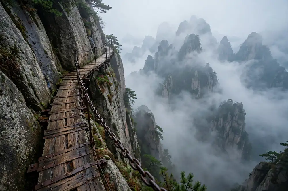
Mount Huashan is famous for one thing: its terrifying paths. Several lists, including trekking blogs and travel guides, describe its plank walk as possibly the most dangerous hiking trail in the world. The Changkong Zhandao is a narrow set of wooden planks bolted to a sheer cliff face, where you clip a harness onto a chain and shuffle sideways with a huge drop beneath your feet.
Is it really among the hardest hikes? Physically, not quite. The stairs and steep climbs are tiring, but they’re nothing compared with a multi-week trek. Mentally, though, it’s a major test. If you’re afraid of heights, this is a very hard hike indeed.
It’s also busy. Queues form at the plank path, and the mountain has become a major tourist site with cable cars and paved walkways. Safety has improved over the years with harnesses and staff, but the exposure is still real, and it’s best to avoid wet or foggy days.
Our tip: Go on a weekday, wear a snug harness, and keep both hands free. Leave the phone in your pocket until you’re off the planks.
15. Ciudad Perdida (Lost City), Colombia
Length: about 44 km (27 miles) round trip | Time: 4-5 days | Highest point: roughly 1,200 m | Best season: December to March (drier months)
Ciudad Perdida, also called Teyuna, is an ancient settlement built by the Tayrona people in the mountains of Colombia’s Sierra Nevada de Santa Marta. Getting there is a jungle trek of about 44 kilometres over four to five days, and expert hiking lists regularly put it among the toughest treks in South America.
It’s a different kind of hard. There’s almost no altitude. Instead, the challenge is heat, humidity, river crossings, mud and a long staircase of about 1,200 stone steps leading to the site. You sweat constantly, your clothes never fully dry, and insects are a nuisance. Rain can turn paths into streams and make river crossings tricky.
Because the route passes through Indigenous territory, you must travel with a licensed local operator, and it’s important to follow local rules and respect the communities along the way.
People who complete it often describe it as a mix of fitness test and cultural experience. You’ll sleep in simple camps, swim in rivers and eat meals prepared by local cooks.
Our tip: Pack quick-dry clothes, spare socks and insect repellent, and keep electronics in dry bags.
Must Read : Best Areas to Stay in Seoul: 12 Neighborhoods Compared
Quick Comparison: Which Kind of Hard Is Right for You?
Not everyone wants the same type of challenge, so here’s a simple way to match hikes to your strengths.
- You love long, remote expeditions: Snowman Trek, Kanchenjunga, K2 Base Camp.
- You want altitude without ropes: Aconcagua, Three Passes, Huayhuash.
- You like a mental and physical test of endurance: Appalachian Trail, GR20.
- You prefer short but intense: Kinabalu, Half Dome, Umbwe.
- You want a different type of challenge: Chadar (cold), Ciudad Perdida (jungle), Huashan (exposure).
How to Train for One of the World’s Hardest Hikes
The best preparation depends on your target hike, but a few principles apply to almost all of them. Whether your goal is one of the hardest hikes in the world or a tough local trail, these principles hold.
Build an aerobic base. Start at least three to four months before a big trek, and six months or more for a multi-week expedition. Aim for three to five cardio sessions a week, mixing steady runs, cycling, swimming or stair climbing. Add one long weekend hike with a loaded pack.
Strengthen legs and core. Squats, lunges, step-ups and planks help your knees survive long descents. Strong calves and glutes save a huge amount of energy on steep climbs.
Train with your pack. Gradually increase pack weight until it matches what you’ll actually carry. Break in your boots long before departure, because blisters ruin more trips than any mountain.
Practise altitude strategy. You can’t fully train for altitude at sea level, but you can plan for it. Choose itineraries with built-in acclimatisation days, climb high and sleep low where possible, and learn the early signs of altitude sickness: headache, nausea, dizziness and unusual fatigue. Talk to a doctor about preventive medication if you’re heading above 4,500 metres.
Practise cold and wet conditions. Try your layering system in bad weather close to home. Knowing how to stay warm and dry is a core skill, not a bonus.
Sort out insurance. Many standard travel policies exclude trekking above a certain altitude. Check that yours covers helicopter evacuation and the altitude you’ll reach.
Essential Gear for Extreme Hikes
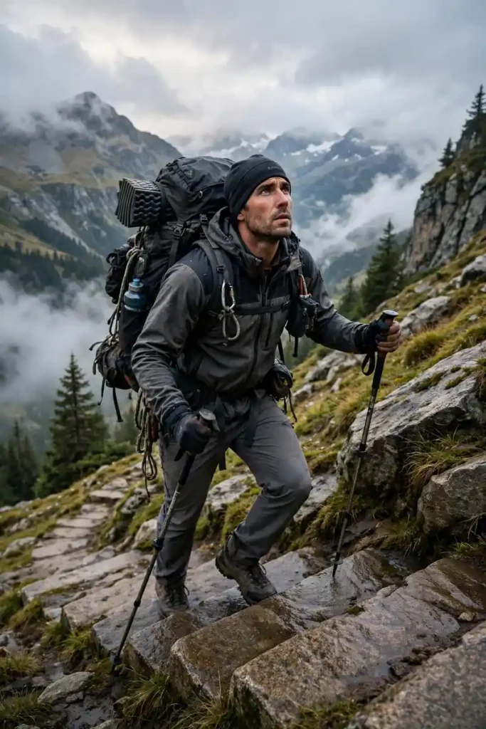
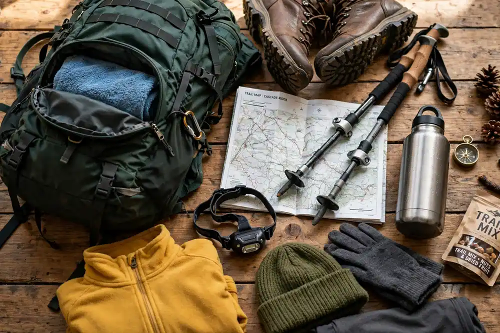
Gear lists vary by route, but these essentials show up again and again:
- Broken-in waterproof boots and several pairs of moisture-wicking socks
- Layered clothing: base layer, insulating mid layer, windproof and waterproof shell
- A sleeping bag rated well below the expected night temperature
- Trekking poles to protect knees on long descents
- Sun protection: UV-rated sunglasses, high-SPF sunscreen, a wide-brim hat
- A headlamp with spare batteries
- Water filter or purification tablets
- A well-stocked first aid kit, including blister care and your own prescriptions
- A satellite messenger or other emergency communication for remote areas
- Maps, a GPS device and the knowledge to use them
Common Mistakes That Ruin Hard Hikes
- Ascending too fast. Altitude sickness is the number one reason treks fail. Slow is smooth, and smooth is far.
- Ignoring weather windows. Choosing the wrong season is a recipe for misery. Check seasonal patterns for each route.
- Overpacking. Every extra kilo costs energy. Pack what you need, then remove a few things.
- Skipping the guide on remote routes. Many of the trails above require licensed guides by law, and for good reason.
- Neglecting nutrition and hydration. Appetite drops at altitude, so eat regularly even when you don’t feel like it.
- Letting the summit overrule your judgment. Turning around is not failure. It’s how experienced hikers live long enough to try again.
Read Also : Most Overrated Cities in the World (2026): 12 Places That Rarely Live Up to the Hype
Final Thoughts
The hardest hikes in the world aren’t only about suffering. They’re about the way a long, difficult trail strips life down to a few basics: walk, eat, sleep, repeat. You learn quickly what you can carry, what you can leave and how much you can endure when you’ve got no other choice.
If you’re new to extreme hiking, don’t jump straight to number one. Work up gradually. A tough multi-day trek at moderate altitude, followed by something like Kilimanjaro or the Three Passes, will teach you far more than a rushed attempt at a monster route. And whichever trail you choose, respect local communities, follow the rules, leave no trace and keep your ego out of the decision-making. That discipline matters on the hardest hikes in the world more than anywhere else.
Pick one that scares you a little, prepare properly and go.
Frequently Asked Questions (FAQs)
1. What is the hardest hike in the world?
There’s no single official answer, but Bhutan’s Snowman Trek is the one most often named. It runs roughly 300 km over 25 to 30 days, crosses around 11 high passes and has a reported completion rate of about half. Kanchenjunga, K2 Base Camp and Aconcagua are common runners-up, depending on how you judge difficulty.
2. What is the hardest hike in the US?
It depends on what you count. Many guides point to The Maze in Utah’s Canyonlands for its remoteness and navigation, and to Half Dome in Yosemite for its steep cables and long day. For sheer duration, the 2,200-mile Appalachian Trail thru-hike is in a class of its own.
3. Is Everest Base Camp one of the hardest hikes?
It’s one of the hardest non-technical hikes because of the time you spend at high altitude, with the route reaching about 5,364 metres at base camp and higher if you climb Kala Patthar. But with tea houses, good trails and a well-planned itinerary, it has a high success rate for prepared trekkers. The Three Passes variation is considerably harder. It is the Everest route in this list of 15, not the standard Everest Base Camp trek.
4. What is the most dangerous hike in the world?
Lists differ, but trails like Mount Huashan’s plank walk, the Chadar frozen river trek, Half Dome’s cables and Peru’s Huayna Picchu often appear. Danger is different from difficulty, though. A scary, exposed trail can be short and technically easy, while a very hard trek can be low-risk with good support.
5. Do I need a guide for the hardest hikes?
Often yes, and on many routes it’s the law. Bhutan, Pakistan’s K2 region, Kanchenjunga, Kinabalu and Ciudad Perdida all require licensed operators or guides. Even where it’s optional, a good guide brings local knowledge, safety judgment and rescue coordination that can make or break a trip.
6. How fit do I need to be?
For the hardest routes, you need strong cardiovascular fitness, leg strength and the ability to walk six to nine hours a day for consecutive days. Previous experience at altitude matters as much as gym fitness. Start with shorter high-altitude treks first, and see a doctor before attempting anything extreme.
7. How can I avoid altitude sickness on high treks?
Ascend gradually, schedule acclimatisation days, stay hydrated, avoid alcohol and learn to recognise early symptoms. Ask your doctor about preventive medication. If symptoms get worse, the only reliable cure is to descend, so never ignore warning signs.
8. What is the best time of year for these hikes?
It varies by region. Himalayan routes are generally best in April-May and October-November, with Bhutan’s best windows around spring and autumn. The Karakoram around K2 is best in summer. Patagonia and Aconcagua work in the southern summer, and the Chadar is only possible in deep winter. Always confirm local conditions before you book.
9. How much do the hardest hikes cost?
Costs swing widely. A self-organised Kinabalu or GR20 trip can be relatively affordable, while organised expeditions to Bhutan’s Snowman Trek, K2 or Aconcagua can run into several thousand dollars once you add permits, guides, porters, transport and insurance. Always ask operators exactly what is included.
10. Is it OK to turn around before finishing?
Absolutely. Turning back because of weather, illness or fatigue is part of mountain culture, not a failure. Plenty of experienced trekkers have turned back more than once before reaching a summit or finishing a route, and they do it precisely because they plan to keep trekking for years to come.